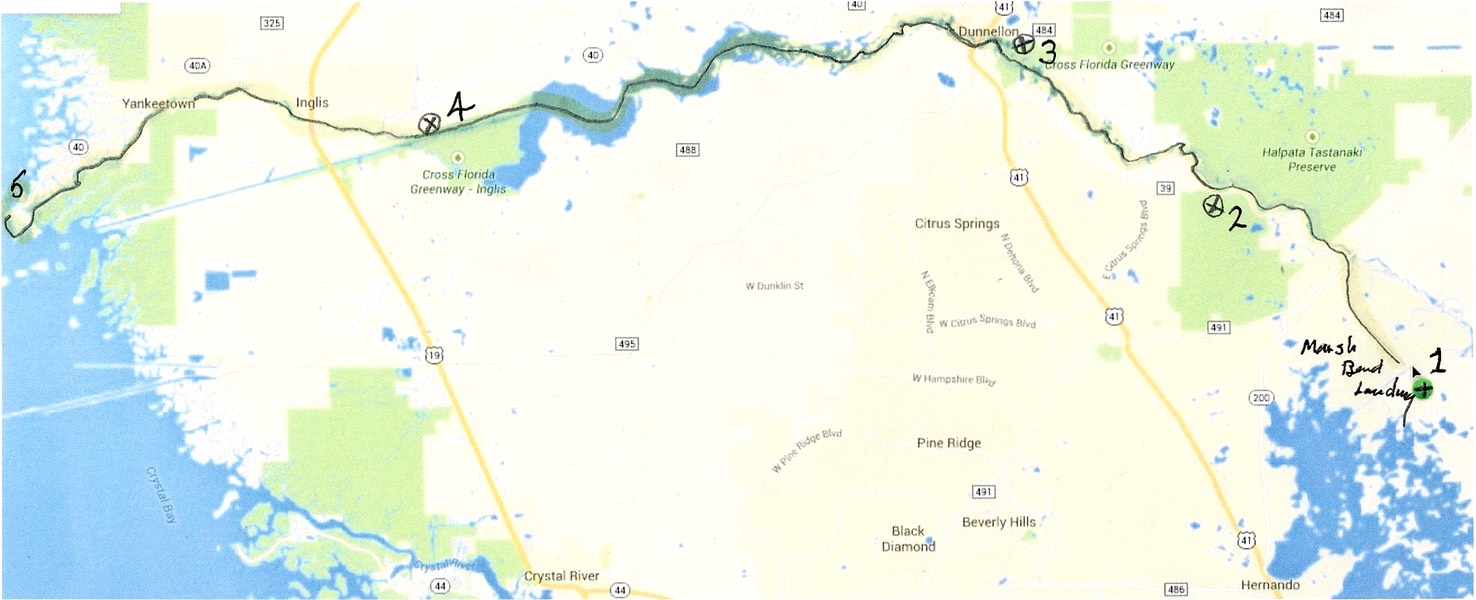
Follow our route from right to left starting at Marsh Bend Outlet Park (#1). Inglis Lock is #4 on the map.
TRIP DATA: February 19, 2015
Distance Paddled: 17.1 miles
Moving Time: 4H, 38M
Moving Average: 3.7mph
Stopped Time: 49 M, 45 S
Overall Average: 3.1mph
Trip Duration: 5H, 28M
Trip Odometer: 54.3 miles

What a day! Three words describe it: sunshine, cold and wind. Sunshine was the good part, sun and mostly clear skies. But this was offset by cold, sharp cold, penetrating cold, that arrived the previous evening and stayed with us all day. Cold combined with heavy biting wind, wind that increased all day and made paddling difficult.
I debated with myself all night about how I would dress for paddling in the morning. In the end I elected to wear a heavy zip neck shirt, my Polartec vest and swim shorts these I covered with my waterproof paddling jacket and pants. On my feet, Sealskins neoprene socks and Keen water shoes. On my head a Tilly wide brimmed hat and sunglasses. These, along with my spray deck and PFD kept me warm enough all day
The first 8.5 miles of the trip were paddled mostly in shade my. My exposed fingers were really cold and my arthritic hands ached. We covered the 8.5 miles to our lunch stop in one hour and 49 minutes averaging 4.4 mph. At our lunch stop some delicious Cuban sandwiches were provided by Citrus County. I ate one even though it was only a couple of hours after breakfast.
Ron, Ray and I headed out after 35 minutes. Shortly we were in Lake Rousseau, a man-made lake intended to create hydropower and as a passage for oceangoing ships on the ill-fated Cross Florida Canal. The lake is nine miles long and oriented roughly east to west. Today there was a strong and building north west wind blowing toward us as we paddled to our camping destination at the defunct Inglis lock.
The lake is relatively open, more so as you approach it's Western and. It is studded with hidden cypress stumps, remnants of the clearing done to create the lake over 100 years ago. A winding channel has been marked through the lake to avoid collisions with these obstructions. Before the channel was marked there were numerous deaths caused by power boaters hitting these hidden stumps. Since the new channel has been marked, there have been none.
The wind increased as we headed down the lake. By the last two of our 17 miles the wind had built to 25 mph, the seas were running 2.5 feet high and were splashing over our decks. I was worried that Ron, who didn't have a spray deck, might take on too much water and swamp. He did take on some water but was okay. We arrived at Inglis lock between 1:30 and 2 PM. Ron was the third Person to arrive, I was the fourth and Ray was the fifth out of some 35 paddlers.
Cold weather and high winds dominate this leg of the trip.
I set up my tent in the biting wind. The measured air temperature at 3 PM was 47°, 45 with windchill! Fortunately, we were able to use a heated building on the Inglis Lock property for dinner and had a great presentation of the Marjorie Harris Carr Cross Florida Greenway. Several people have elected to sleep in the building tonight, even though there seems to be a friendly mouse scurrying around the place.
Tonight’s temperature is supposed to hit a record low, somewhere in the mid 20s. Unbelievable! It's 42° in my tent right now at 8:30 PM. The sky is absolutely clear with a billion stars showing. The wind has dropped to zero. So the setting is right for a big drop in temperature. We shall see.
COMMENTS:
