The National Park Service does not allow paddlers to plan and reserve campsites along the Everglades Watertrail in advance. Paddlers may outline a desired route and bring it to the National Park office in either Everglades City or Flamingo no more than twenty-four hours in advance of departure. If those sites are available, they can be booked. If not, alternate sites must be chosen. We contracted with an experienced Everglades guide, Joel Beckwith, partly because in knowing the various sites, he could make good alternate choices for our large group.
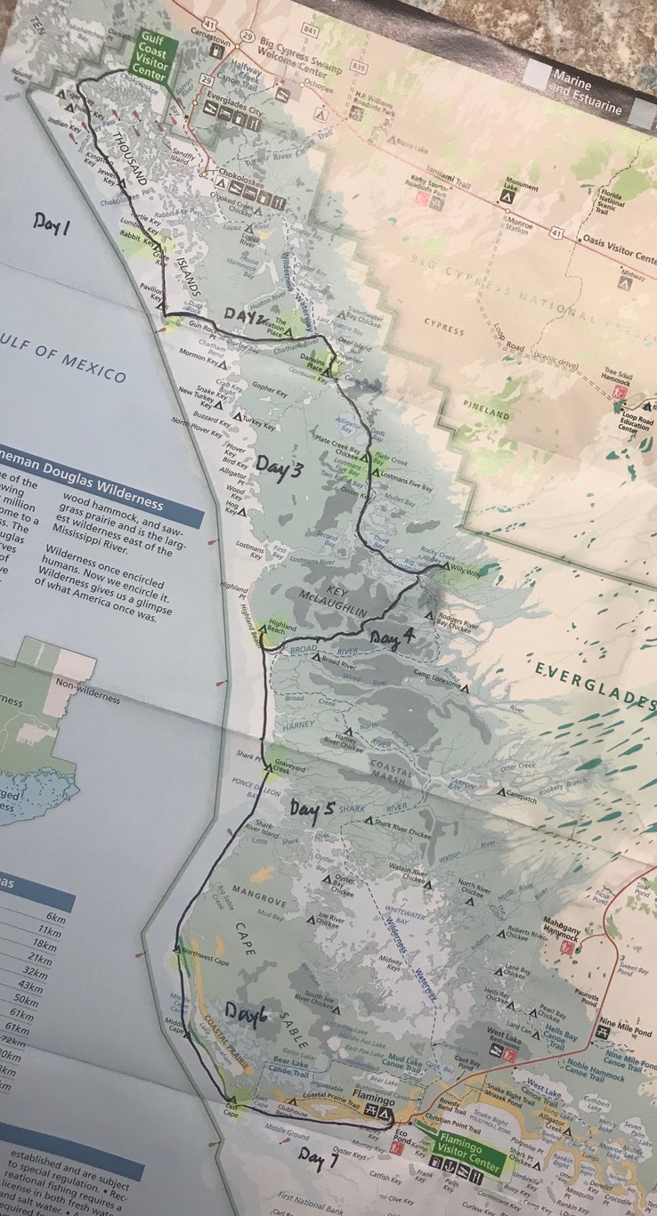
The itinerary and map below show the route we paddled. We were assigned to all of these sites. But in fact, we skipped Graveyard Creek on Day 5, pressing on to NW Cape Sable a day early, because Joel knew it was a very large site that could accommodate several large groups, if we needed to stay put for a day because of weather.
On Day 7, we elected not to stay two nights at East Cape. We pressed on to Flamingo, the end of our trip, arriving there in the rain a day early. This was to avoid expected very low water the next day on Florida Bay that would have made our journey to Flamingo very difficult.
Our Itinerary
- Day 1, January 26: Everglades City to Pavilion Key (12 miles)
- Day 2, January 27: Pavilion Key to Darwin’s Place (13 miles)
- Day 3, January 28: Darwin’s Place to Willy Willy (17 miles)
- Day 4, January 29: Willy Willy to Highland Beach (16 miles)
- Day 5, January 30: Highland Beach to Northwest Cape Sable (20 miles)
- Day 6, January 31: Northwest Cape Sable to East Cape (10 miles)
- Day 7, February 1: East Cape to Flamingo (10 miles)
- Day 8, February 2: Second Day at Flamingo (98 miles paddled in total)
- Day 9, February 3: Shuttle back to Everglades City (131 miles by van)
Our route plotted on a map.